
Here are the 06z NAM and GFS runs from earlier today:
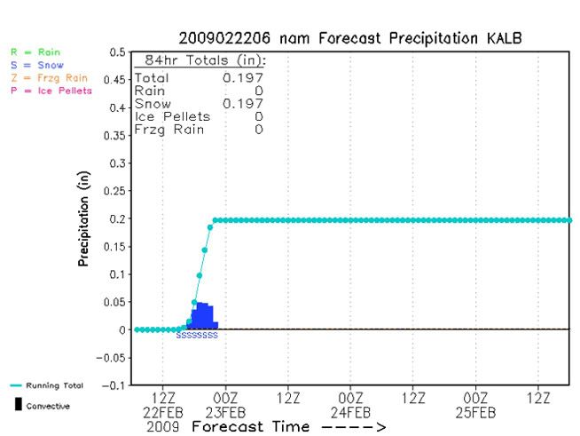
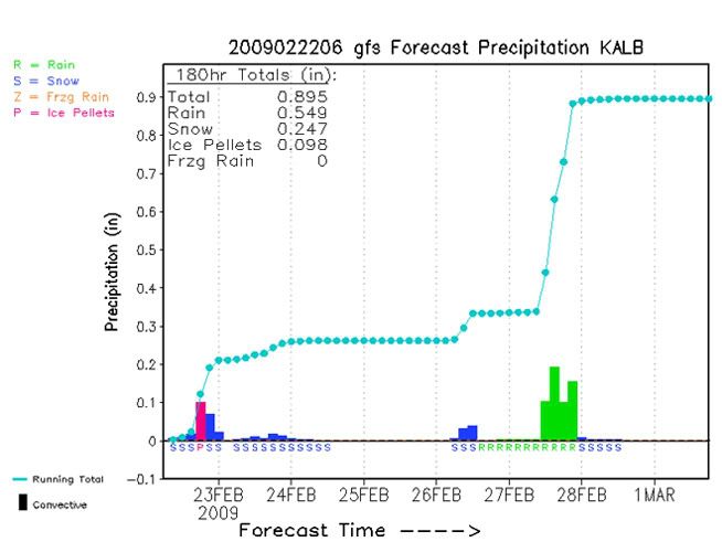
This correlates into about 2-4" of snow for the Albany area. I'm going with 1-3", since there is a possibility of some mixed precip during the storm if the surface warms up enough. Not a bad event, but it's peanuts compared to parts of northern New England, Maine in particular. Some areas are expected to get 12-18" of snow by the end of the storm tomorrow night, with localized areas of 18-24". Yeah...they can have that for all I care.
And of course there's going to be lake effect for those who live further west, but that's just a given.

No comments:
Post a Comment