
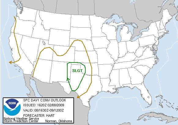
For the short term, there is a slight risk of severe storms just east of the Rockies, mostly in western Texas. This storm has a VERY SLIGHT risk of producing tornadoes, but we'll likely just see some wind and hail reports from this system.
Day 1 Outlook (tornado: 2%, hail: 15%, wind: 15%):
What we're really watching is the storm that forms in the wake of this one, which is forecast to have a much higher potential of producing severe storms and tornadoes than the one that is currently forming. Day 3 brings a much higher risk of supercell thunderstorms and tornadoes, and it looks like this second system could produce our first tornado outbreak of the season. If not, then it certainly has the capacity to produce a lot of wind and hail reports. CAPE is going to be the make-or-break factor for the chance of tornadoes, which, at this point, is forecasted to max out around 500-700 J/kg, whereas environments more favorable to tornadoes have at least twice as much CAPE. If this storm can gather enough energy, it will become powerful indeed.
Day 3 Outlook (overall chance of severe weather):

This stronger storm is forcasted to move northeast from the Great Plains, and enter NYS early Thursday morning. However, this is still a reasonable amount of uncertainty with this storm as to where it will track. The "doomsday scenario" for NYS includes a brief period in the warm sector of this storm, which could give us the potential for severe weather before the storm moves out. The more likely scenario is that NYS just gets a few showers, with brief periods of moderate rain.
But one can always dream...

No comments:
Post a Comment