Monday, June 30, 2008

One Report To... Report

Wind damage in Northeast NYS gave us our only report for today:

06/28/08


Not too much excitement there.

...Almost caught up!

Sunday, June 29, 2008

Storms Hit Closer To Home, Still Nothing To See

Storms eluded me once again today, as seen here:

06/27/08


Still waiting for that sweet one!

Severe Weather Scrape NYS Borders

Storms along the SW and NW borders of NYS were hit by a few storms, bringing up several severe weather reports:

06/26/08


The good stuff stayed out of the state for the most part.

Thursday, June 26, 2008

Hail Along The East Border

A couple of rather unexpected storms hit NYS, just north and east of Albany, dropping some hail reports:

06/24/08


The surprisingly-unstable air mass remained in New England for the majority of the day, yet was never given a watch box for some reason. The convective outlook was changed to a slight risk in the northeast when severe weather began breaking out in eastern Massachusetts, but that was it.

Tuesday, June 24, 2008

Youtube Video Going Up

I'm currently uploading a video of my brief chase from June 22, 2008 to youtube... and it's taking a loooong while to get it fully uploaded. I'll edit this post when it's ready to be viewed.

UPDATE:
Finally uploaded... ready to watch!

Severe Storms Hit NYS, Miss Bloggers

Scattered hail and wind reports came in yesterday, all of which missed myself and Mark M. We're still looking for bloggers to cover more of NYS, so if you're interested, drop us an e-mail!

06/23/08


Today, we have scattered showers and storms. Probably not going to have severe weather in Albany today, but there is a slim chance.

Monday, June 23, 2008

Funnel Cloud Spotted Near Albany

I went out after a tornado warning posted just north of me. I saw and recorded a wall cloud and possible funnel cloud with this storm, which also produced two-inch hail.

06/22/08


Other than that, it was pretty calm around Albany. Most of the other severe reports were south and east, with isolated reports in Central NY.

Pictures of the storm are up! Also, a friend of mine gave me a nice hail picture from the June 16 storm... be sure to check that out, too (1.75-inch hail stone!)

Sunday, June 22, 2008

More Reports

A few more reports for today...

06/21/08


Looking for a more interesting day on Sunday.

A Few Storms Pass

A few storms caused a ruckus in Southern NY, providing NYS with some wind and hail.

06/20/08


Nothing too special for today. Hopefully more interesting stuff to come!

Thursday, June 19, 2008

Stormy Weather Despite Cooler Temps

The cooler-than-average temperatures aren't helping us get severe weather, but NYS did mange to sneak in a few reports of wind and hail for the 18th:

06/18/08


We got a thunderstorm here in Albany, but it wasn't that spectacular. I still need to go through some footage, but that will have to wait because I'll be out of Albany until Sunday.

Wednesday, June 18, 2008

NYS Gets Lit Up With Green

Many, MANY hail reports throughout NYS, along with some spotty wind reports. Two-inch hail was reported in the town over from me. I was working up in Latham, so unfortunately I did not get the best view for these storms. I did manage to grab a few shots from it, which can be seen in the pictures area.

06/16/08


There was even a confirmed tornado in Orange County! Sure, it was an EF0 that only lasted a short while, but it was there!

Now for a long cold stretch.

Onondaga County Gets Some Hail

One report for June 15th for hail that hit about 6-7 miles away from my parent's house:

06/15/2008


Nothing else that's special for this day.

Monday, June 16, 2008

NYS Goes Moderate, Winds Improve

Today's forecast wind is looking much more favorable for storm development. Not only has the speed shear improved, but low-level directional shear is looking much better than it did yesterday. With this increased hazard, parts of NYS have been placed in the moderate area for severe weather. Wind is still the greatest concern, but now I can actually throw in the possibility of a tornado. Some medium- and even possibly large-sized hail is also possible with these storms today.

06/16/2008


Cameras are good to go!

Sunday, June 15, 2008

Severe Storms Hit Southern NYS

Just catching up on my severe reports here. Had some wind and hail reports in southern NYS yesterday. NYC got some nice storms as well, as reported by Mark M.

06/14/2008


As for me, I saw some lightning, but it wasn't that special. I tried to get a little something photographed, but the storm wasn't photogenic. Perhaps tomorrow's storms will show off their wild side for me.

Tomorrow Keeps Looking Better

It looks like Albany will get some initial rain and thunderstorms in the late morning hours, followed by daytime heating and then perhaps some severe thunderstorms in the evening. The severe threat in NYS is approaching the moderate scale, with parts of southern NYS in the 30% chance with a hashed area.

06/16/2008


The indices and lapse rate are looking good, but the wind profile is lacking in the severe department. Very little directional shear and weak-to-moderate speed shear will hinder the development of strong storms. Wind damage and small hail are certainly a concern with the storms.

After tomorrow, expect a period of cooler-than-average temperatures and chance of rain showers. This pattern is likely to last through the weekend, so updates will be less frequent for the next week or so.

Saturday, June 14, 2008

June 16 Is Looking Good For Storms

Today's Day 3 Outlook from the SPC is showing a good portion of NYS in the slight-risk area for severe storms on June 16:

06/16/2008


Steep lapse rates and plenty of moisture will definitely get us some boomers, but the less-than-ideal wind speed shear and minimal directional wind shear will hinder our ability to get severe storms in NYS.

The models are in a bit of disagreement with the west-east movement of this incoming storm, so there's still room for this forecast to change.

Western NY Gets Wind, Hail

Slow-moving storms lumbered across Western NY yesterday evening, producing about a dozen wind damage reports along with one hail report. A couple of these storms also produced localized flooding in isolated areas. At one point, the doppler radar observed a cell south of Rochester producing rainfall at a rate of 3.5 - 4 inches per hour!

06/13/2008


The weakening system is heading east today, which will hopefully give the rest of NYS some action before it moves on. Most of the storms will be garden variety, but a few might become severe. The main concern for today is localized flooding, as storms will likely move very slowly due to weak upper-level winds.

Skies are clear here in Albany, which was expected. The storms are supposed to hit us in the early evening, which is good because I have to work until 5:00pm, so hopefully I won't miss anything.

Friday, June 13, 2008

Thunderstorms Possible Tomorrow In My Area

There's some storms in western NY today, which will probably spawn a severe report or two. Tomorrow, the threat extends into all of NYS. Unfortunately, conditions will be far from ideal for severe weather, but we might be able to still get some good lightning photos from the storms that do pop up.

The storms should hold off until I get out of work, and then it's on to either the campus or the NWS to observe the weather.

Thursday, June 12, 2008

WUnderground Widget

I've added a "Weather Sticker", which is provided by WUnderground. I think it adds a nice little touch to the blog. I'd also like to add the ENX radar if I can find a way to embed that for free.

Wednesday, June 11, 2008

NYS Gets Butchered By Storms

NYS, as well as most of the New England and Mid Atlantic states, got ripped a new one by the frontal passage. It was quite an exciting day all over, and Albany finally took a direct hit by a thunderstorm! Wind damage was reported in the nearby town of Colonie. Mark M. also reports that NYC got hit hard as well, and he might have pictures for us soon (if he can find the memory card!).

06/10/08


Pictures are up from my footage, and I hope to append more photos to it from my actual camcorder, which seems to have difficulty with lightning in low light. I will have to fiddle around with it a bit. Luckily I was intelligent enough to also pull out my old camera to at least supply some photos for now.

Another Day, Another Day Of Reports

Just a couple of wind reports for today. One injury was reported due to the wind in Clinton County.

06/09/08


Not the most exciting of days, with one day left for the heat wave.

The NYS Severe Weather Continues

Hail and wind again reported in NYS, narrowly missing Albany yet again. Although NYC did get scraped, I don't believe Mark M. was able to get much from it.

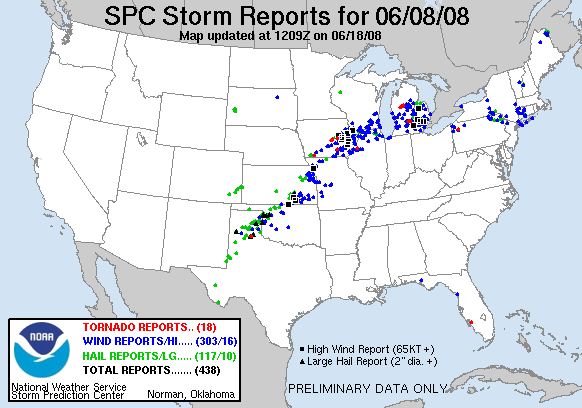
06/08/08

Tuesday, June 10, 2008

Catch-Up And Today's Weather

I'll have to play catch-up for the last couple days of severe weather... just been busy. Today, we are already in a tornado watch for most of NYS east of Rochester. We already have a report of hail in Monroe County, and it's 10:30am!

Definitely going to be a great day for storms in NYS.

Saturday, June 7, 2008

Cluster Of Storms Hit Eastern/Southern NY

I was able to get my first pictures of the year! I was disappointed when I found that converting the movie file into MPEG format killed the resolution, so I'm going to have to find some way to edit the full-quality video. When I do, I'll replace the existing photos (which aren't much to talk about, anyway).

The pictures are taken from Latham, NY. The cell itself had a severe thunderstorm warning, and produced wind damage in Saratoga County. There was also wind damage reported in Westchester County.

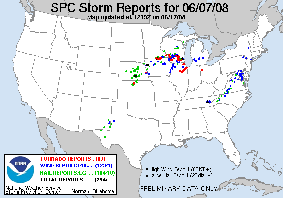
06/07/2008


The storms seem to be winding down for today, but we've got three more days of potential before the front comes through and puts us back to climatological conditions.

Friday, June 6, 2008

MCS Rolls Over NYS

A lazy, lack-luster MCS is traveling across NYS tonight, but there are a few embedded thunderstorms that may produce a severe report or two. There were a few reports of wind damage in the Rochester and Oswego county areas. Hail was also reported just outside of Albany in Guilderland (see UPDATE below).

06/05/2008


It may be 2:30 in the morning, but if I have to stay up all night to catch my first storm of the season... I will!

UPDATE:
It appears as though my late-night excursion actually hurt my chances of seeing a storm, as a thunderstorm which produced dime to penny sized hail passed through my area around 7:00am. I fell asleep at 4:45am, so I was in a deep sleep when it came through.

I just can't catch a break this year it seems. Thankfully, it is still early June, so I still have time to get plenty more storms. It would be nice to actually SEE something though.

Sunday, June 1, 2008

NYS Gets Hit! (Albany Again Disappointed)

Severe weather finally hit NYS good and hard today, with over a dozen hail reports up to quarter and half-dollar sizes, and about the same amount of wind reports. The northern half of NYS, NYC, and Rochester areas were left unscathed by severe weather, but were hit with storms nonetheless.

05/31/2008


Unfortunately for me, the first flashes of lightning in the Albany area occurred approximately 1/2 hour AFTER I went in to work, so all I saw while able to actually record was big, pretty clouds floating by. Hopefully Mark got some action down in Staten Island.