
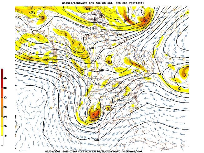
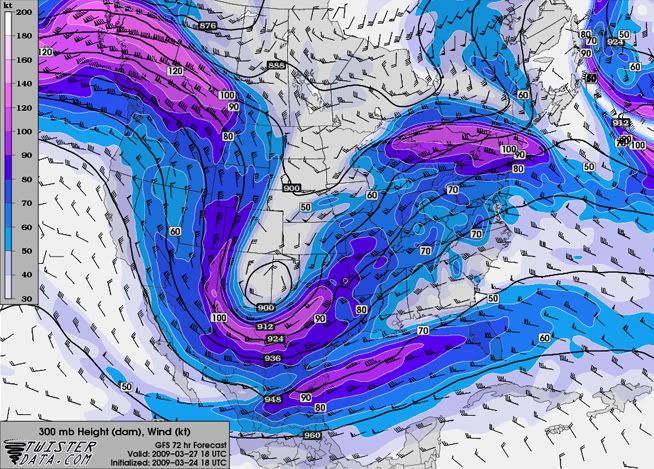
The general consensus among the models shows an impressive upper-level vort max digging into the Texas region Friday as it bottoms out in the large-scale trough. An upper-level jet in the base of the trough will provide southwesterly winds, which will draw the dry upper-level air off of the Mexican Plateau into the South and Southeast. This will create good upper-level lapse rates and decrease the upper-level stability.
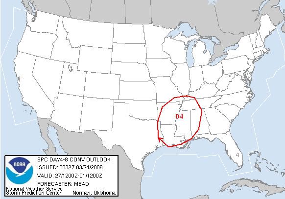
The cold front currently draped over the Midwest and Southeast will stall in the South and Southeast Wednesday, which will continually draw Gulf moisture into the Southeast over the next few days. A couple of weak systems are expected to form off of this boundary and move off to the northeast before the big storm makes its way in. There will be enough instability south of this boundary to initiate some severe weather Wednesday through Friday, but nothing significant is forecasted for this time period.
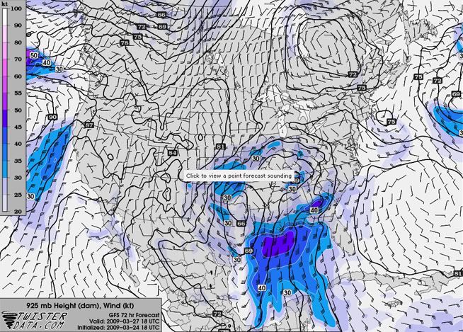
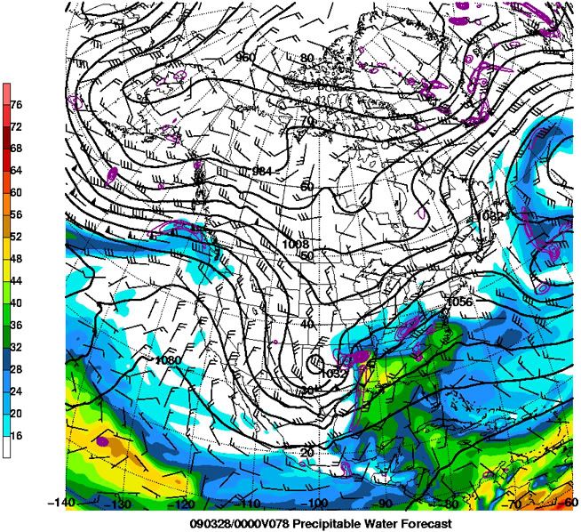
The low-level moisture that will be in place over the Southeast will provide a good source of instability for the main storm when it enters the region, with surface dewpoints forecasted to be in the lower 60s at the time of arrival of the storm. A Bermuda High will also be in place over the next few days, which will enhance the southerly flow off of the Gulf of Mexico.
Along with the impressive vort max in the 500mb level, The strength of the lower- and upper-level jets seem to be the major players for this storm. The main concern is with the forecasted strength of these jets. The GFS has the most robust forecast for this storm, with strong upper-level winds bringing in dry air aloft, and a strong southerly jet in the lower-levels, which will draw the moist Gulf air north and provide significant low-level wind speed shear. Weaker winds for either jet can quickly turn this disaster scenario into a more moderate event.
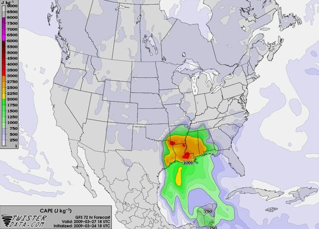
All that being said, I am going to side closely with the GFS, as it has done fairly well with forecasting the first few big troughs of the season, with surprisingly good accuracy in the 4-6 day range. Both the GFS and NAM are forecasting a generous area of 2000+ J/kg CAPE, with some areas possibly exceeding 3000 J/kg CAPE (with a bulls-eye over Louisiana). P-Wat values are forecasted to be in the 1.5"-1.75" range when the storm arrives in the Southeast. Impressive low-level speed and directional wind shear will lead to plenty hail and a good amount of severe wind and tornadic activity in the Southeast. A nice cap will also be present around the 850mb level, before getting eroded by diurnal heating and vertical motion, which rounds out the setup for a classic "loaded gun" environment.

No comments:
Post a Comment