
The ingredients are beginning to mix a little better together as the Big Day approaches. Over the last few days, the models have put together a stronger westerly jet in the base of the upper-level trough, which will serve to bring in drier air off of the Rockies into the upper atmosphere. This will provide the Great Plains with about 500 J/kg more CAPE than was predicted a couple of days ago, putting the total forecasted CAPE in the 1000-1500 J/kg range for the more unstable areas. However, low-level moisture is still an issue, as forecasted surface dewpoints in the 50-60 range for most of the severe weather threat area decreases the great potential instability associated with this storm system.
Wind speed shear associated with a low-level southerly jet ahead of the system has improved as well, which not only increases the low-level instability, but also helps draw Gulf moisture further north. The great wind shear generated by this system will provide a favorable environment for supercell thunderstorms, with plenty of hail, strong winds and some tornadoes.
Storm formation will be hindered in the early part of Monday due to a nice cap in the mid-levels, with a lack of major instability near the surface. The big guns will likely show up in the late afternoon and early evening hours in the Great Plains as the cap breaks down, and push eastward in the overnight hours. The severe storms will likely continue working their way into the Midwest and Southeast Tuesday, causing a bit of mayhem in those regions as well, but they should not be as intense as Monday night's storms.
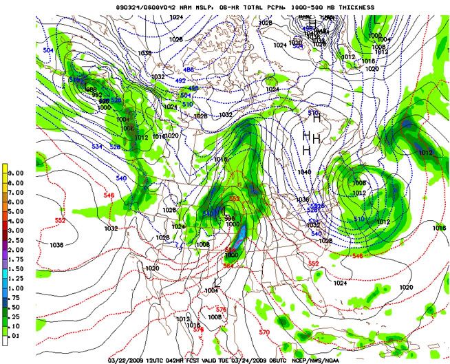
Some pretty forecast graphics for everyone to enjoy:


No comments:
Post a Comment