
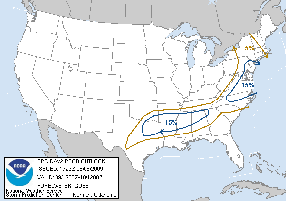
SPC still seems to be underplaying the probability for severe weather, keeping most of NY in the 5% region. However, the 15% bubble has been slowly creeping north over the last few days, which may mean good things for further upstate.
The main concern is that wonderful stuff we like to call "clouds." If the Sun can break them up sufficiently tomorrow, we can see the chance for severe weather rise pretty quickly.
Great wind profile, SFC CAPE progged by NAM and GFS to be around 1000 J/kg... gonna be a good day!
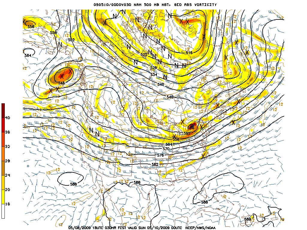
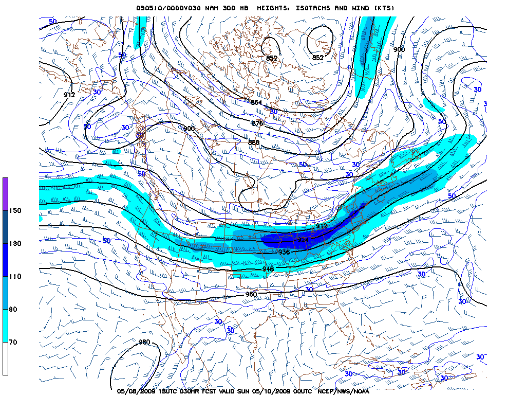
Also expect strong winds following the frontal passage as the powerful shortwave pushes east Saturday night into Sunday.
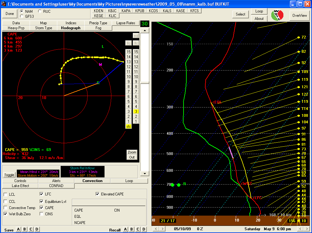
(click sounding to enlarge)

No comments:
Post a Comment