
As this storm lifts out of the upper-level trough, another system will dig into the trough, briefly intensifying it Tuesday before the trough lifts off to the northeast. This could provide southern and eastern NY with a brief period in the warm sector of the low pressure system, which could fuel some decent thunderstorms. A few of these storms may produce small hail and gusty (but non-severe) winds.
Tomorrow:

Tuesday:

But all of this is nothing compared to what we have coming up.
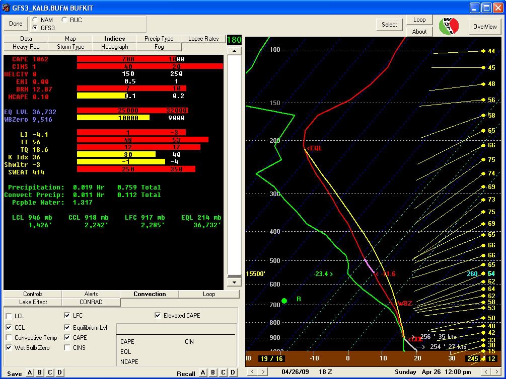
Over the weekend, we're looking at the first real chance for good severe weather in NY. A strong ridge will be in place over the eastern US during the week, and will provide a nice southerly flow in the latter part of the week. This will help draw Gulf moisture and warm temperatures into NY ahead of an upper-level trough, which will be digging down from central Canada. This trough is progged by the GFS to bottom-out just to the west of NY. The GFS may be a little bold with the strength of the instability at this point and time, but high temperatures this weekend are forecast to be a bit warmer than the GFS indicates (as the GFS trends towards climo this far out), so it could also be underplaying some aspects of the instability as well.
Based on the GFS forecast, it looks like a line of storms oriented SW-NE will push east along a cold front through NY Sunday afternoon, providing strong winds and some hail. This is definitely THE storm to track through the upcoming week. Hopefully it will pan out!
Sunday afternoon:

No comments:
Post a Comment